
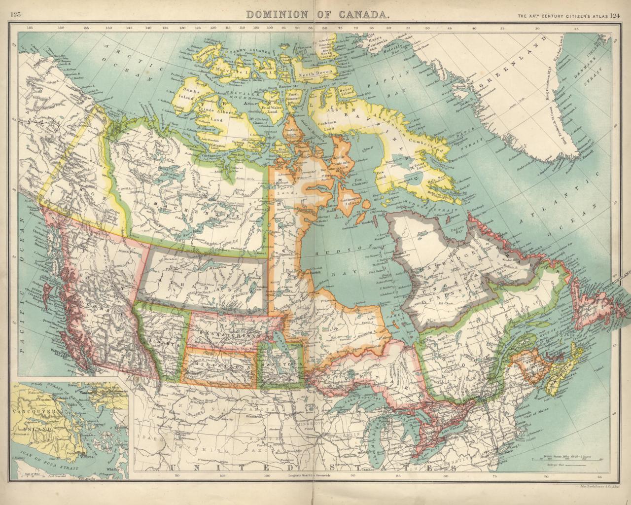
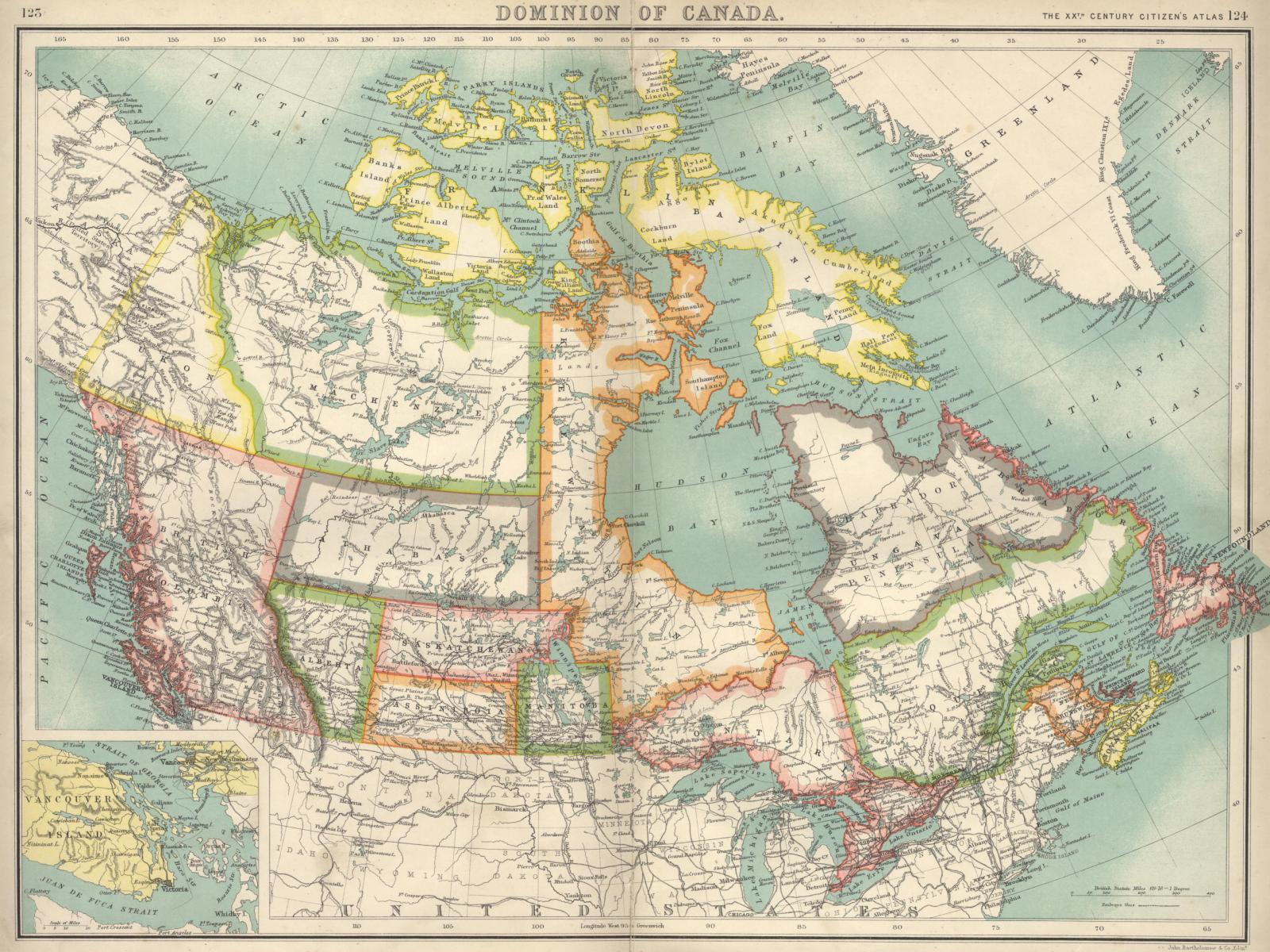
The images on this page are all derived from a single map of the Dominion of Canada. I'm not sure exactly when the map was published since there isn't a copyright date on the map. The map is older than 1905 since that's the year that Alberta and Saskatchewan became provinces and the districts of Athabasca and Assiniboia (shown on this map) disappeared. It can't be much older than that as the text along the top right corner reading "THE XXTH CENTURY CITIZEN'S ATLAS" suggests (but doesn't prove) that it was published sometime in the 20th century. I'm told that Yukon was carved out of the Northwest Territory in 1898. Put it all together and the map was produced somewhere between 1898 and 1904.
Here's the legend and signature area of the map (signed " John Bartholomew & Co. Edinr "):
Click here to get to the top of this set of background image pages.
Some notes are probably in order:
If you use any of these images for commercial purposes or display them on your WWW site, please include a reference back to http://www.bouletfermat.com/backgrounds/ (using the IBM mainframe related images for commercial purposes is probably inappropriate without written permission from IBM).
Speaking of my Grandfather's store, I'm looking for photos, drawings, maps, paintings or any other
documentation dealing with Dumas, Saskatchewan, Canada.
Please contact me if you've got anything (danny@BouletFermat.com).
I suppose that I should add that Dumas had less than 100 people living in it at its peak and,
although there's a sign on the highway and a couple of houses left, Dumas doesn't really exist anymore.
|
Here's the full map scaled to 800x600 (in order to get the aspect ratio right, I had
to stretch the 800x600, 1024x768 and 1600x1200 images about 1% horizontally - the 1280x1024 image is not distorted
since I was able to clip it appropriately).
The 1024x768 version is here. The 1280x1024 version is here. The 1600x1200 version is here.
| ||||||||||||||||||||||
|
| ||||||||||||||||||||||
|
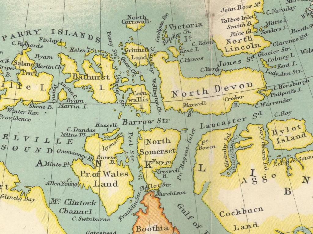
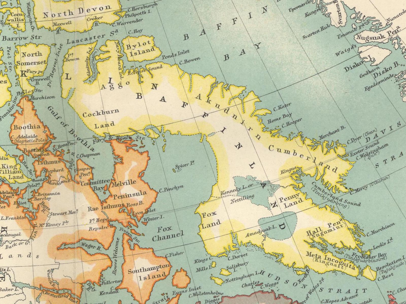
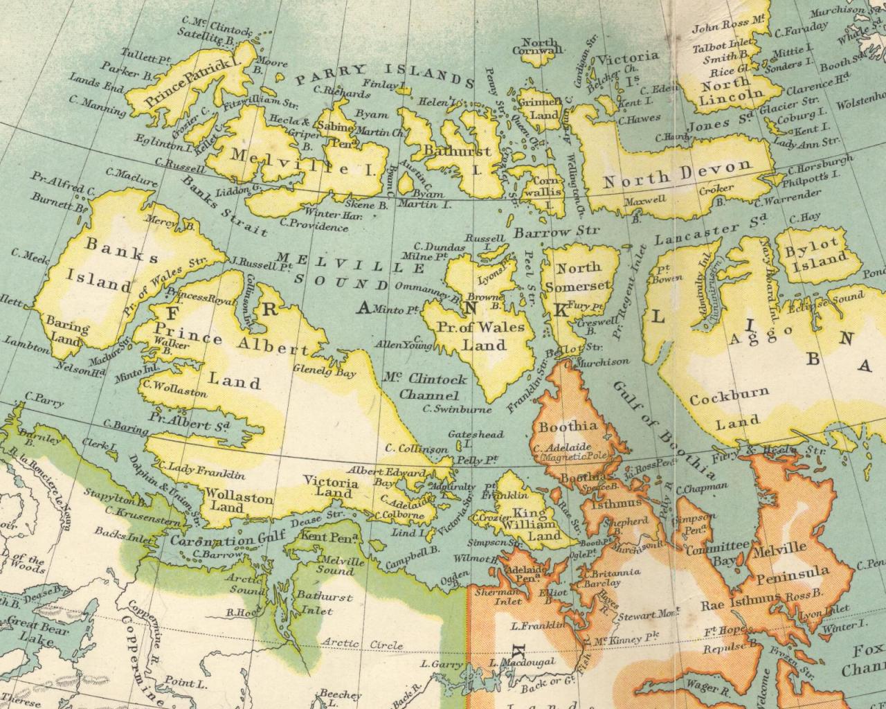
Here's an 800x600 look at the Canadian arctic islands as they were understood ca. 1900.
Note the dotted or completely missing coastlines along some of the islands indicating that
they were as yet unmapped.
Also, a number of these islands have been renamed since this map was published.
For example, Prince Albert Land is now called Victoria Island and North Lincoln is now called Ellesmere Island.
The 1024x768 version is here. The 1280x1024 version is here. The 1600x1200 version is here.
| ||||||||||||||||||||||
|
| ||||||||||||||||||||||
|
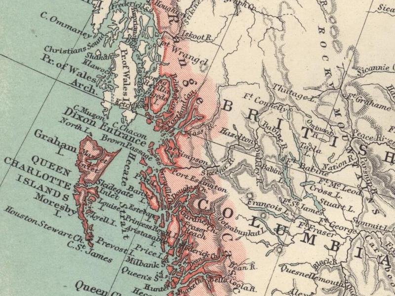
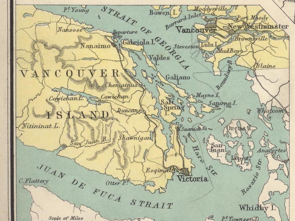
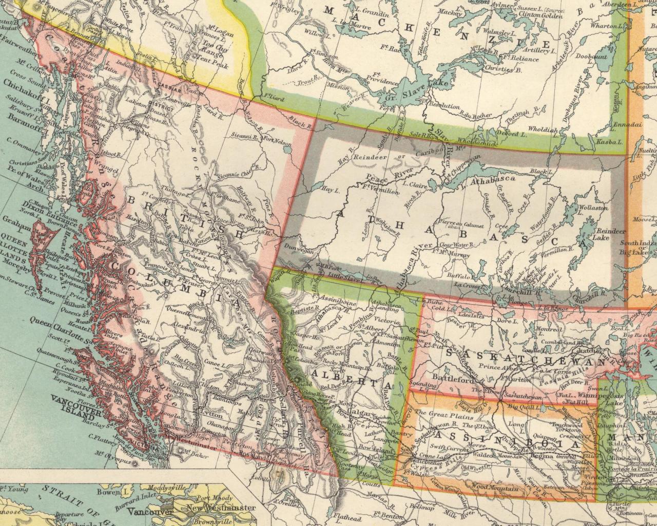
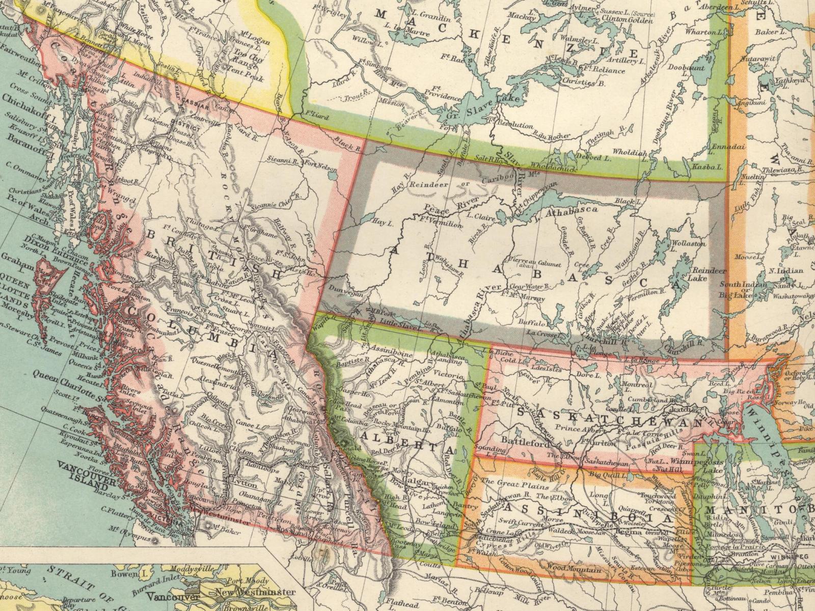
Moving to the southwest, here's an 800x600 look at western Canada ca. 1900.
The borders of the province of British Columbia have been finalized although the other borders shown are all about to
change in 1905 when Alberta and Saskatchewan grow considerably and become provinces.
The 1024x768 version is here. The 1280x1024 version is here. The 1600x1200 version is here.
| ||||||||||||||||||||||
|
| ||||||||||||||||||||||
|
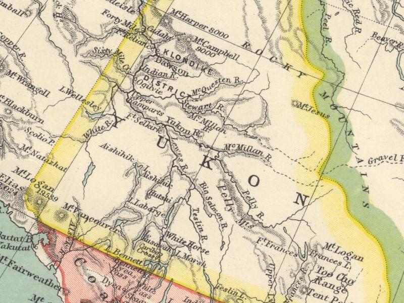
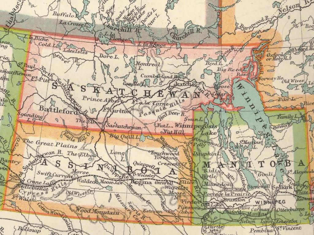
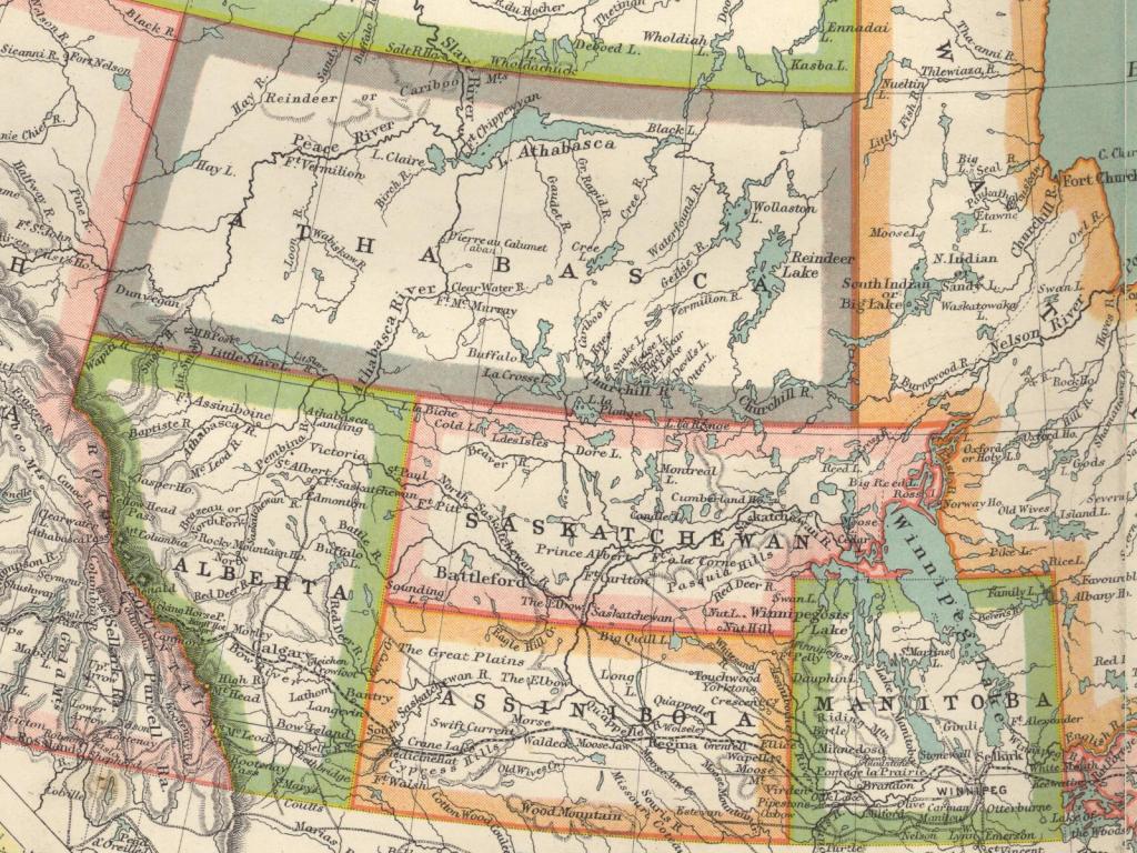
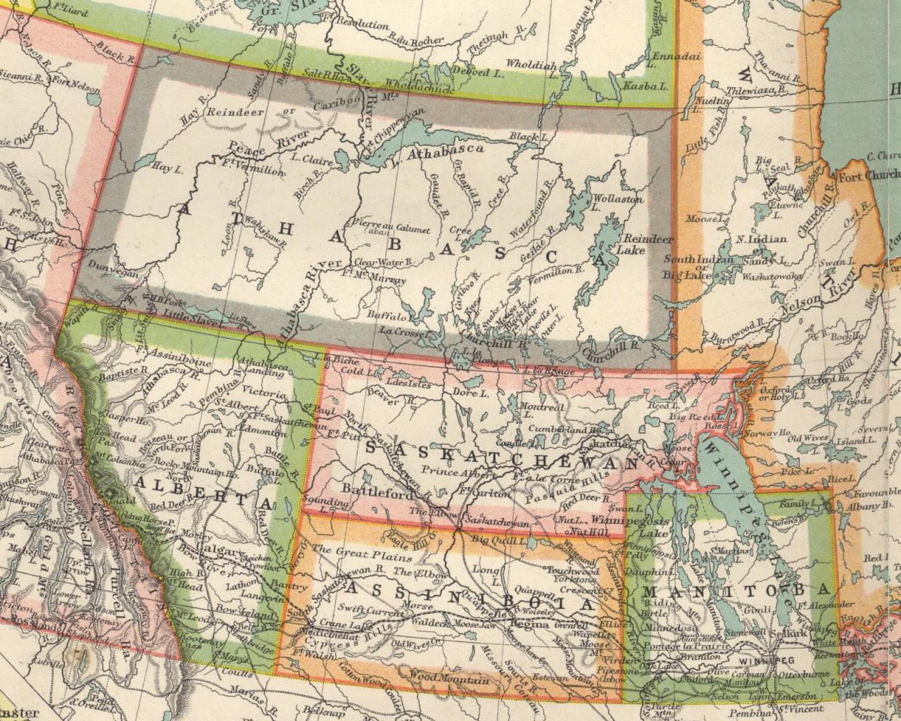
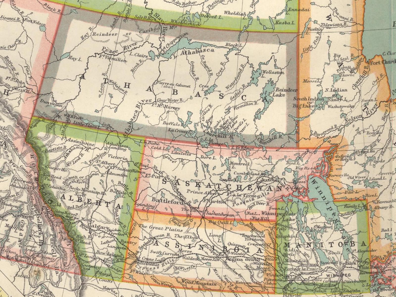
Moving just a bit to the east, here's an 800x600 look at the Canadian prairies ca. 1900.
The provinces of Alberta and Saskatchewan are about to be created (in 1905) out of roughly the land currently
encompassed by the territories of Athabasca, Alberta, Saskatchewan and Assiniboia.
Also, the existing province of Manitoba is about to roughly quadruple in size.
When the politicians are done, the northern border of these three provinces will be the 60th parallel, shown on the
map as the northern border of the province of British Columbia and the territory of Athabasca.
The 1024x768 version is here. The 1280x1024 version is here. The 1600x1200 version is here.
| ||||||||||||||||||||||
|
| ||||||||||||||||||||||
|
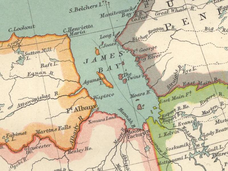
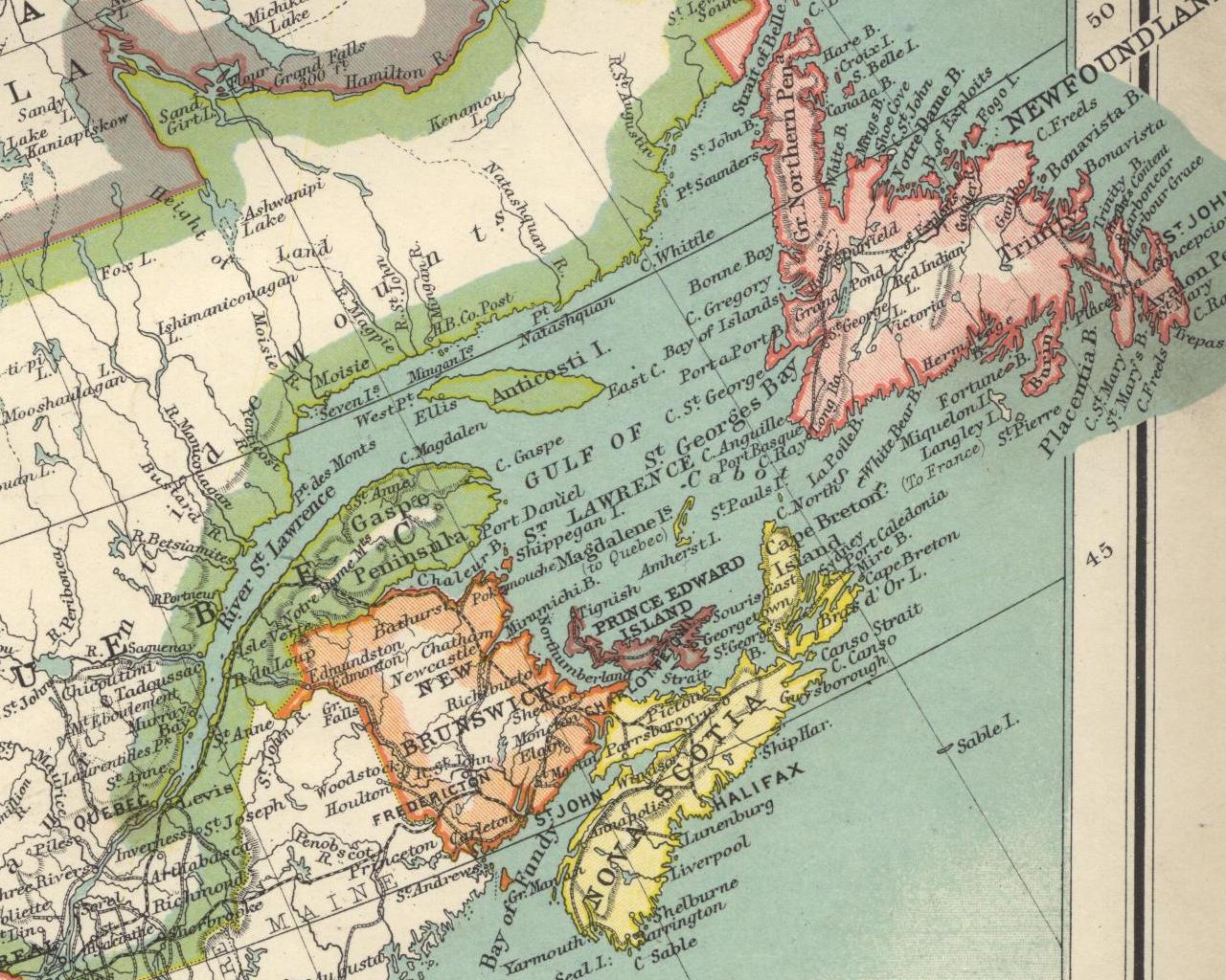
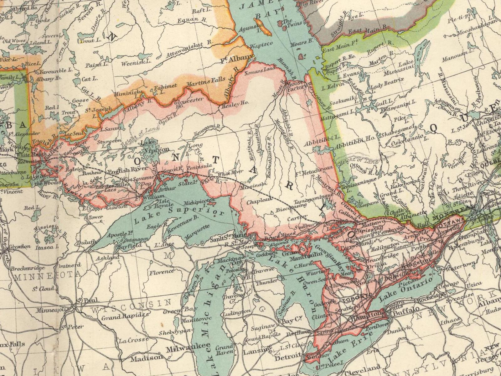
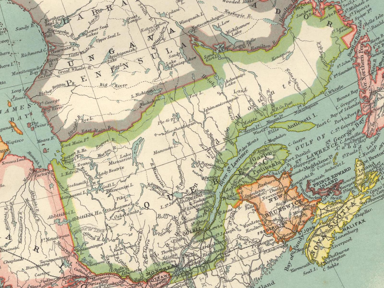
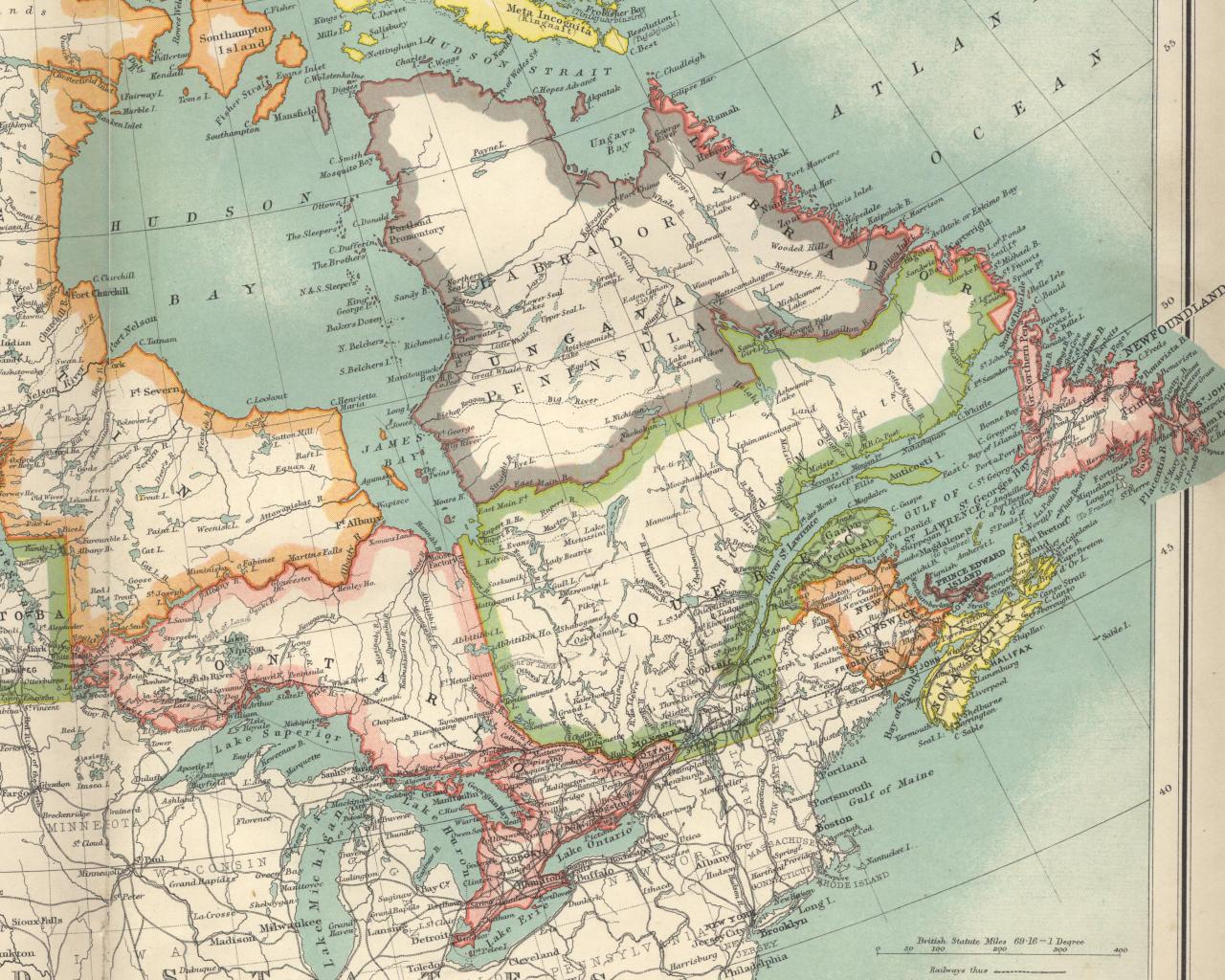
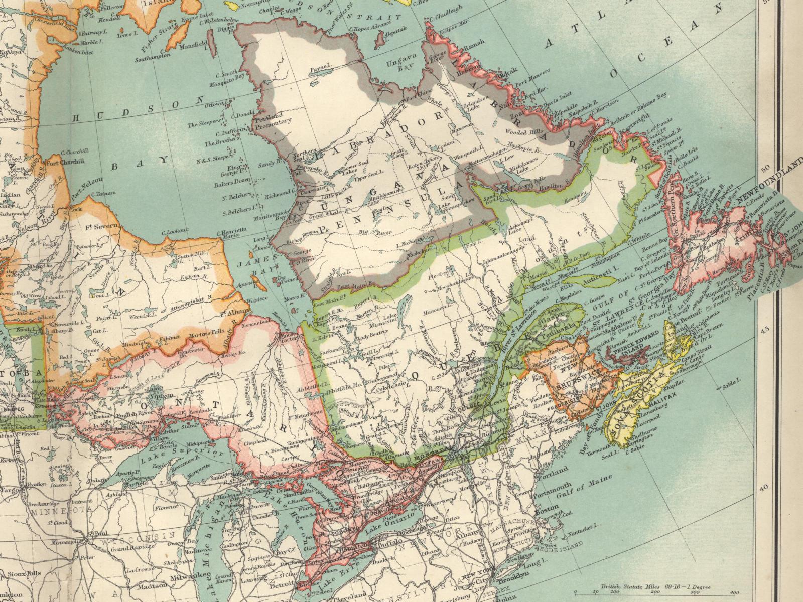
Moving much further east, here's an 800x600 look at eastern Canada ca. 1900.
The provinces of Ontario and Quebec are about to grow northwards, with Ontario soon occupying most of the part of
Kewatin (in orange) visible on this map and Quebec consuming most of the territory labeled Labrador Ungava.
At the far right is the British colony of Newfoundland, destined to become a province in another fifty years.
The maritime provinces of New Brunswick, Prince Edward Island and Nova Scotia are in their final form.
The 1024x768 version is here. The 1280x1024 version is here. The 1600x1200 version is here.
| ||||||||||||||||||||||
|
| ||||||||||||||||||||||
|
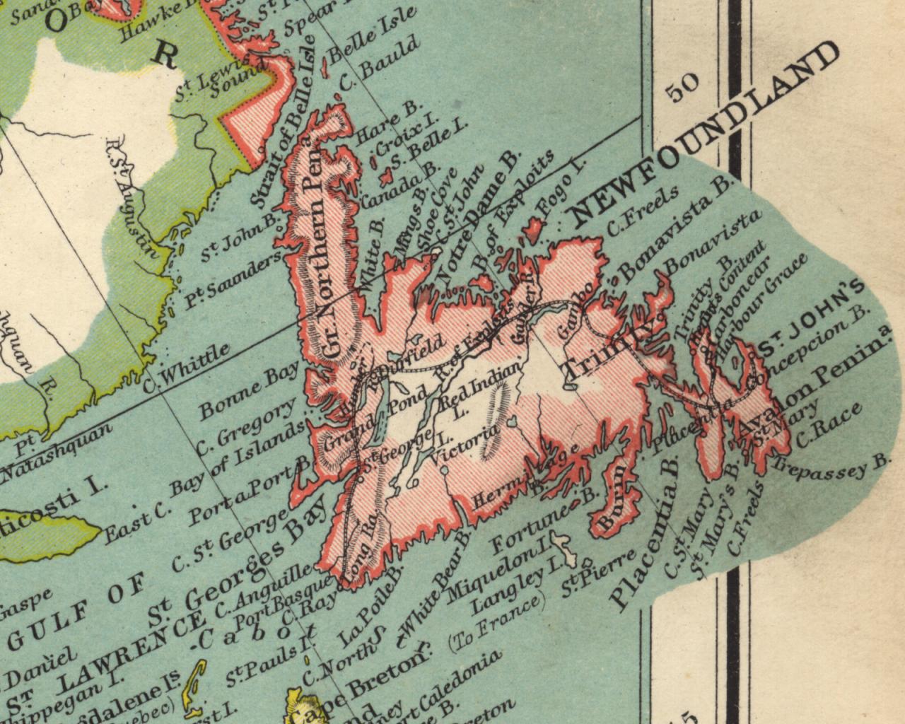
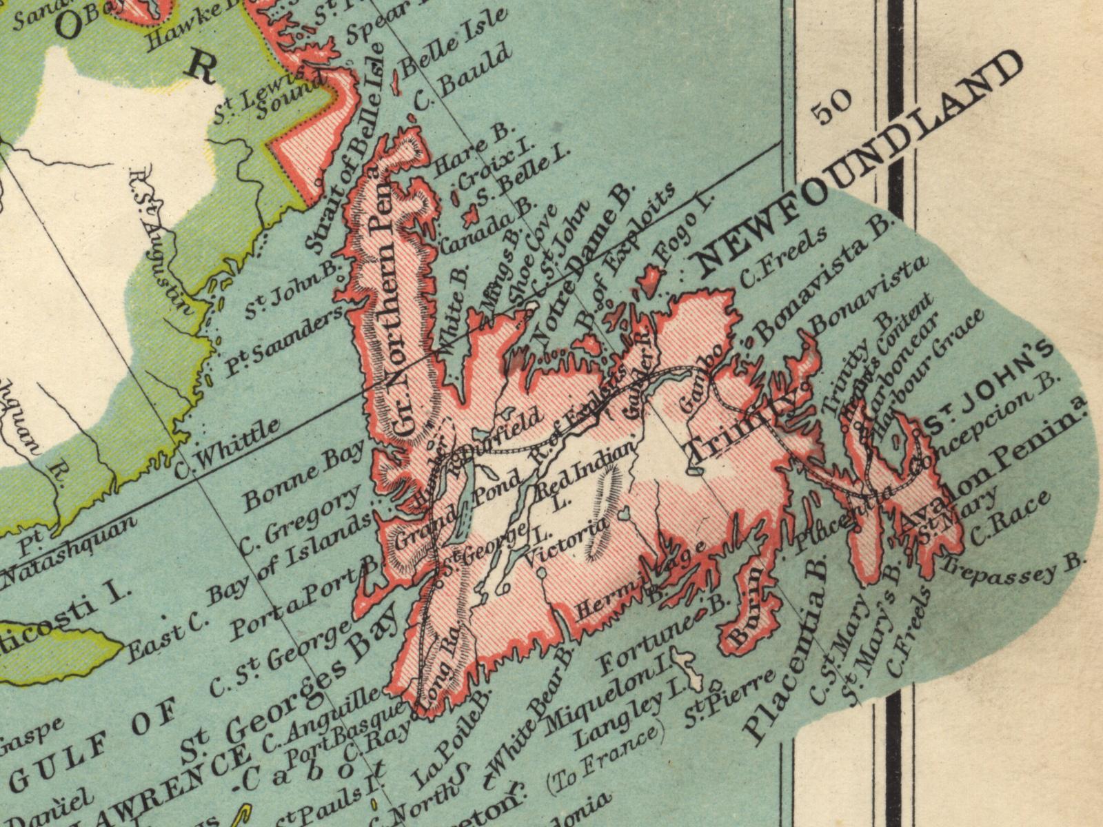
Switching to a higher resolution for a while, here's an 800x600 image of Newfoundland, still a British
colony when this map was produced.
The 1024x768 version is here. The 1280x1024 version is here. The 1600x1200 version is here.
| ||||||||||||||||||||||
|
| ||||||||||||||||||||||
|
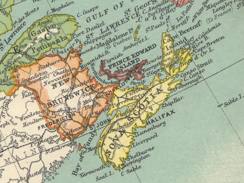
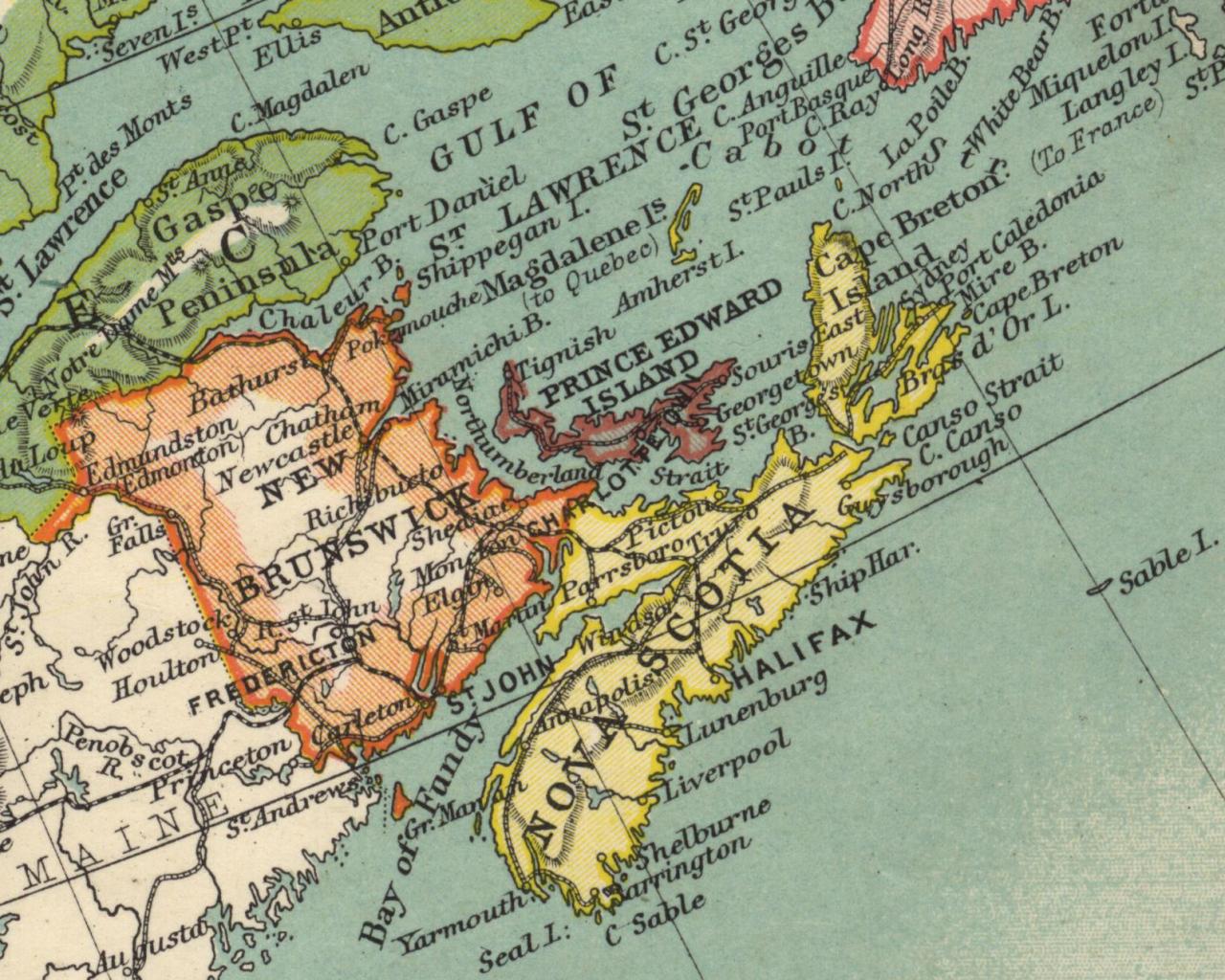
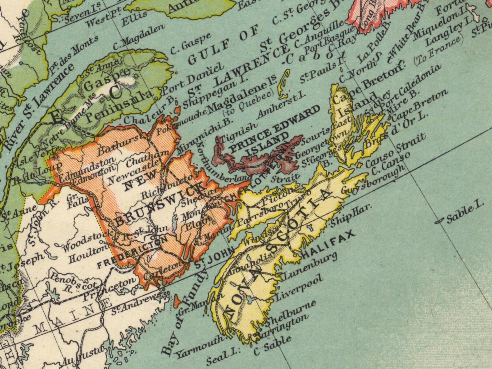
A little further south and west of Newfoundland, we find the Maritime Provinces.
Here's New Brunswick, Prince Edward Island and Nova Scotia in 800x600 format.
Trivia question: From the perspective of when this map was produced, name the four countries which appear in this image. The 1024x768 version is here. The 1280x1024 version is here. The 1600x1200 version is here.
| ||||||||||||||||||||||
|
| ||||||||||||||||||||||
|
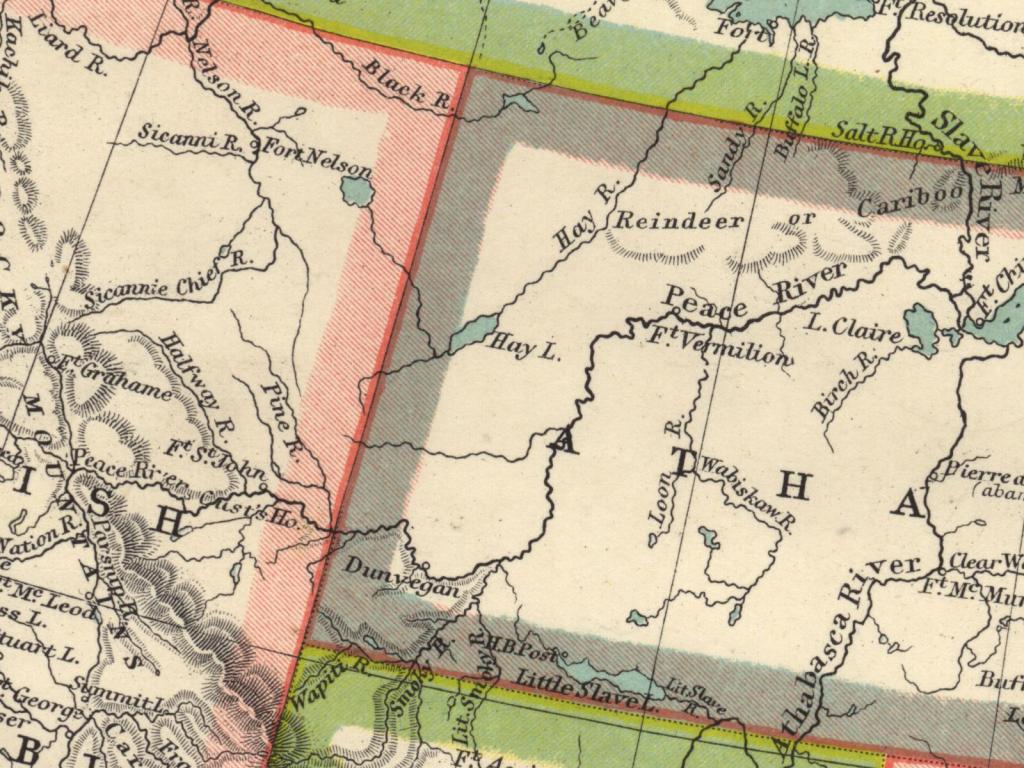
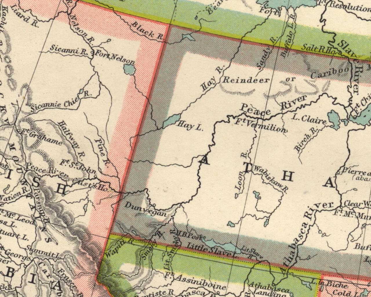
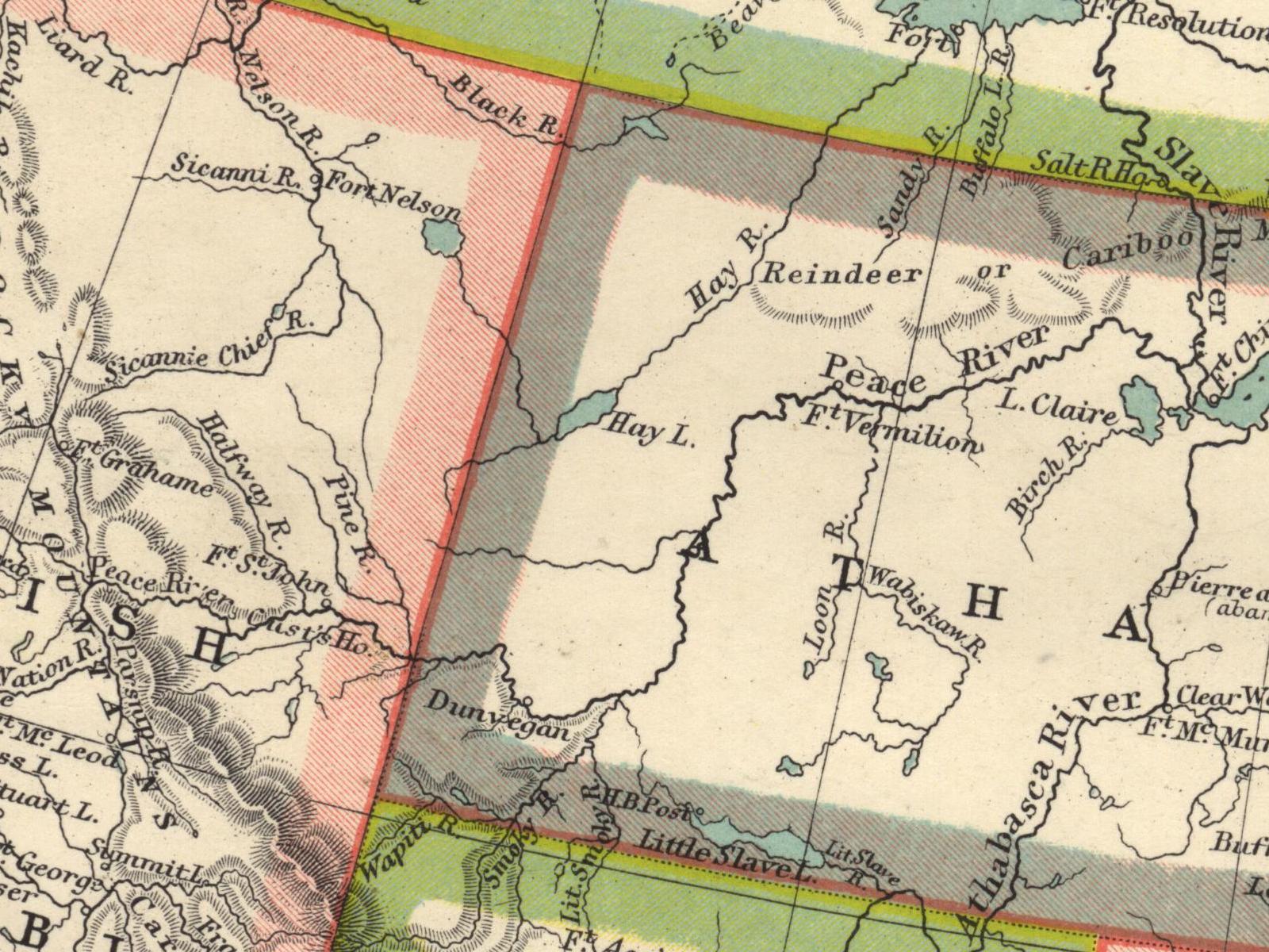
Let's head way back out west and have a look at an 800x600 image of
the Peace River area of what is
now (roughly) northeastern British Columbia and northwestern Alberta.
The 1024x768 version is here. The 1280x1024 version is here. The 1600x1200 version is here.
| ||||||||||||||||||||||
|
| ||||||||||||||||||||||
|
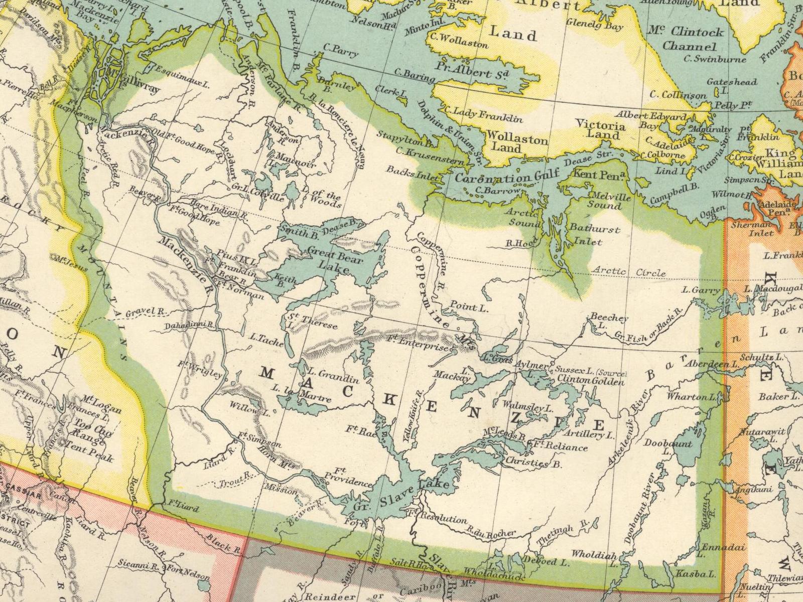
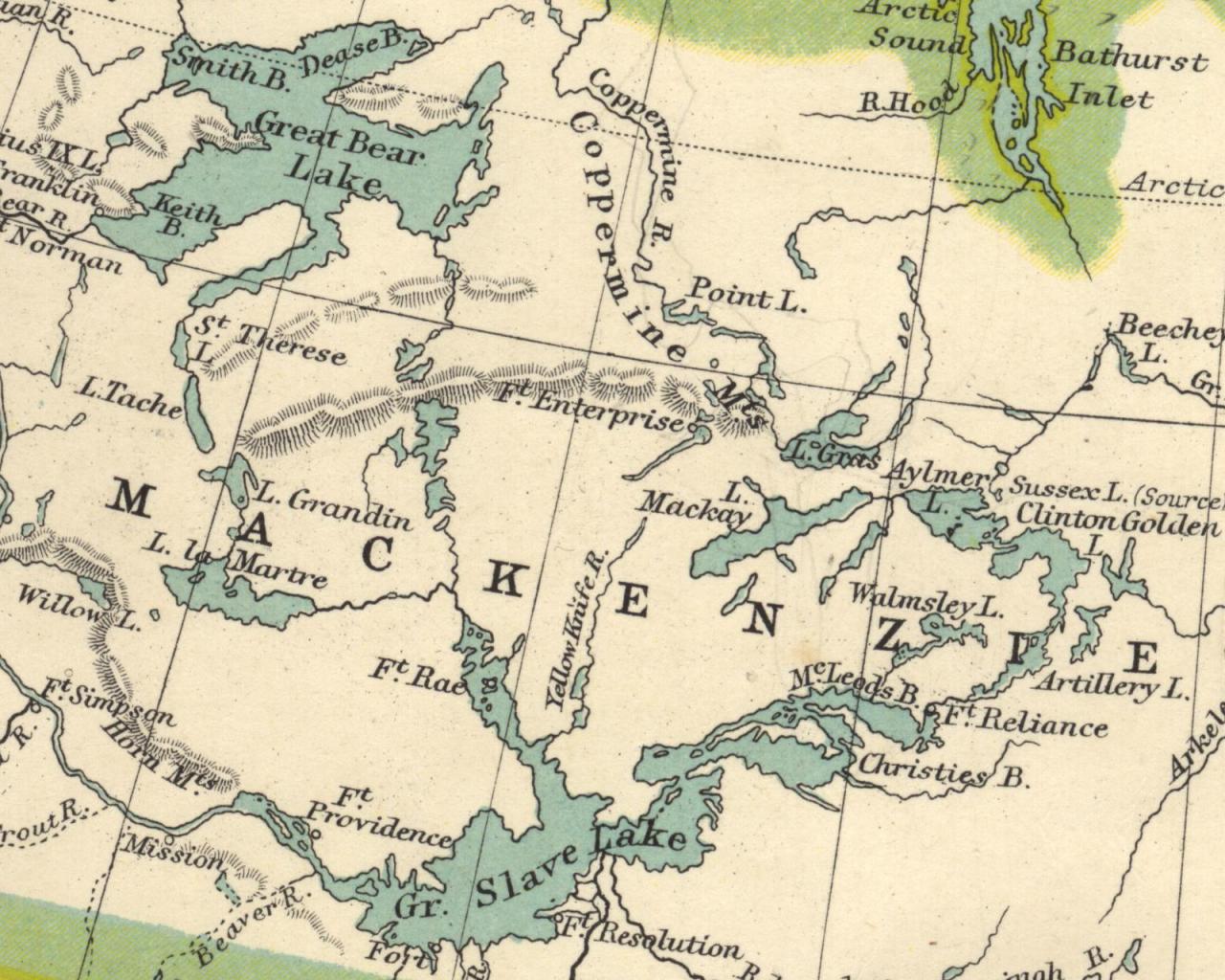
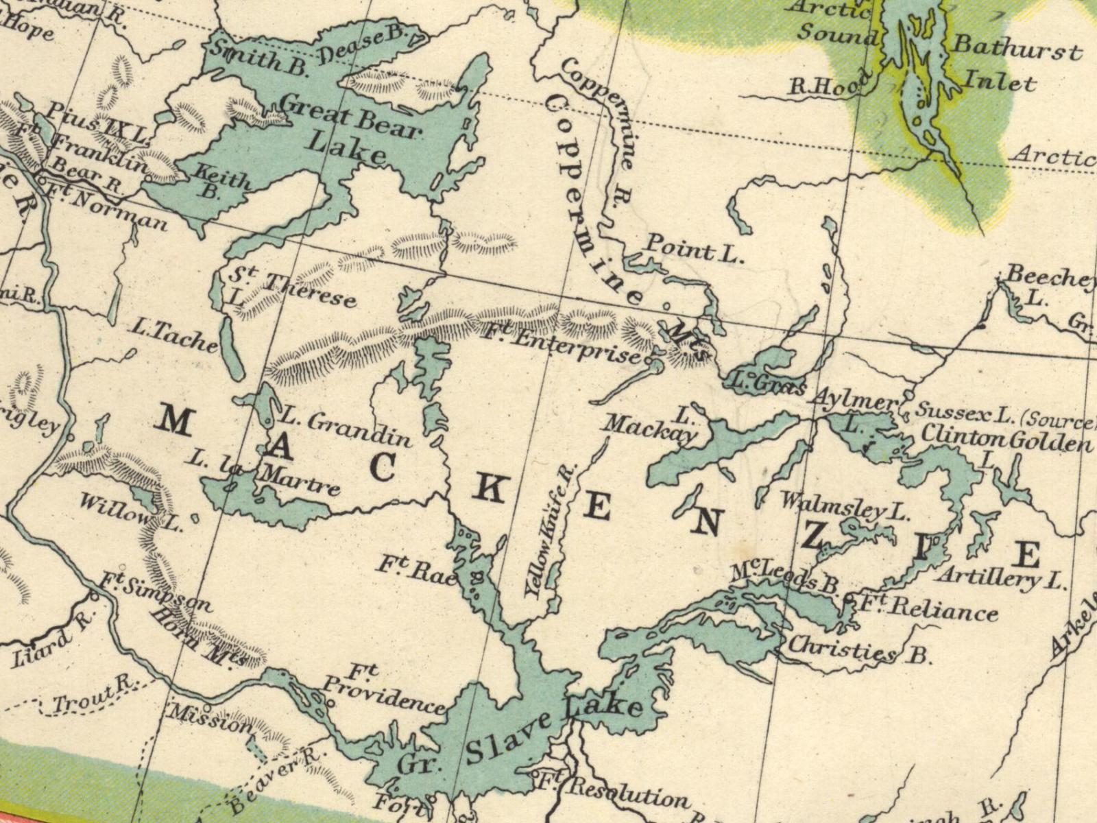
Moving almost straight north, here's an 800x600 image of the two northern great lakes
- Great Bear Lake and Great Slave Lake (in case you're curious, the name Slave
refers to a native Indian nation and has nothing to do with slavery).
The 1024x768 version is here. The 1280x1024 version is here. The 1600x1200 version is here.
| ||||||||||||||||||||||
|
| ||||||||||||||||||||||
|
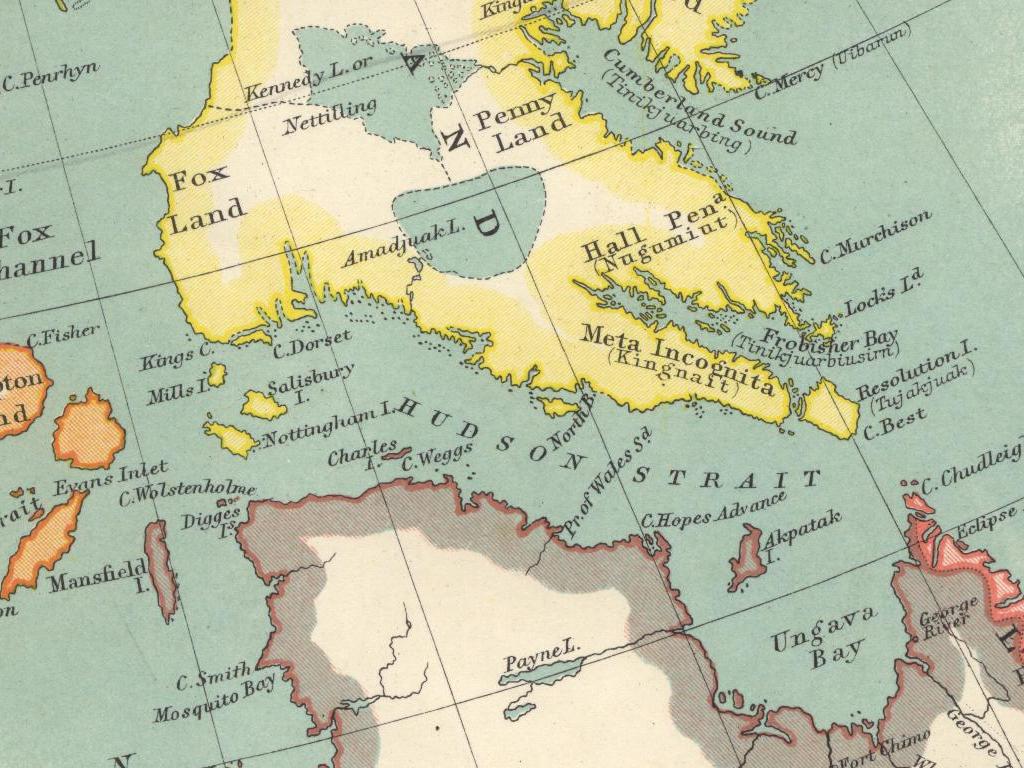
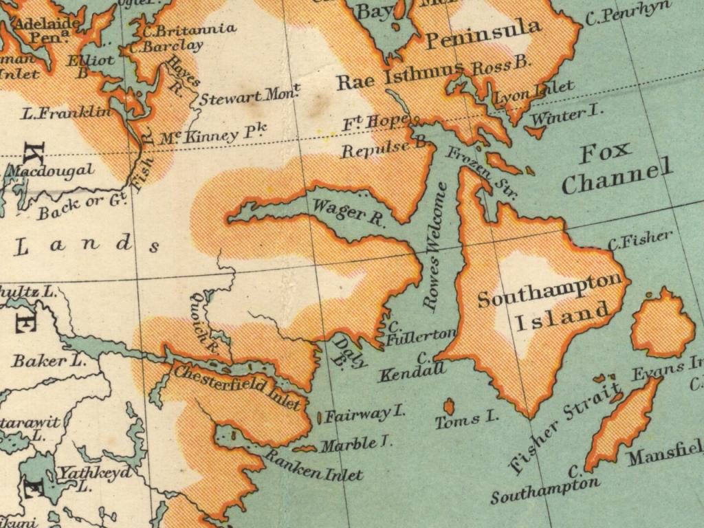
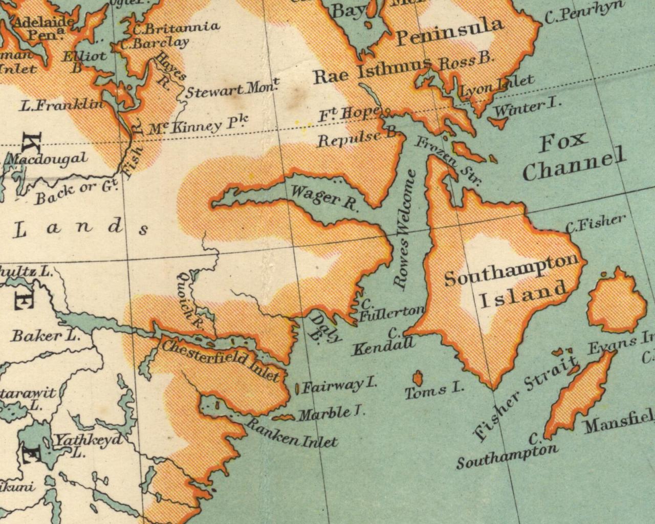
Off to the east and a bit further north, here's an 800x600 image of Southampton Island
and surrounding area.
The 1024x768 version is here. The 1280x1024 version is here. The 1600x1200 version is here.
| ||||||||||||||||||||||
|
| ||||||||||||||||||||||
|
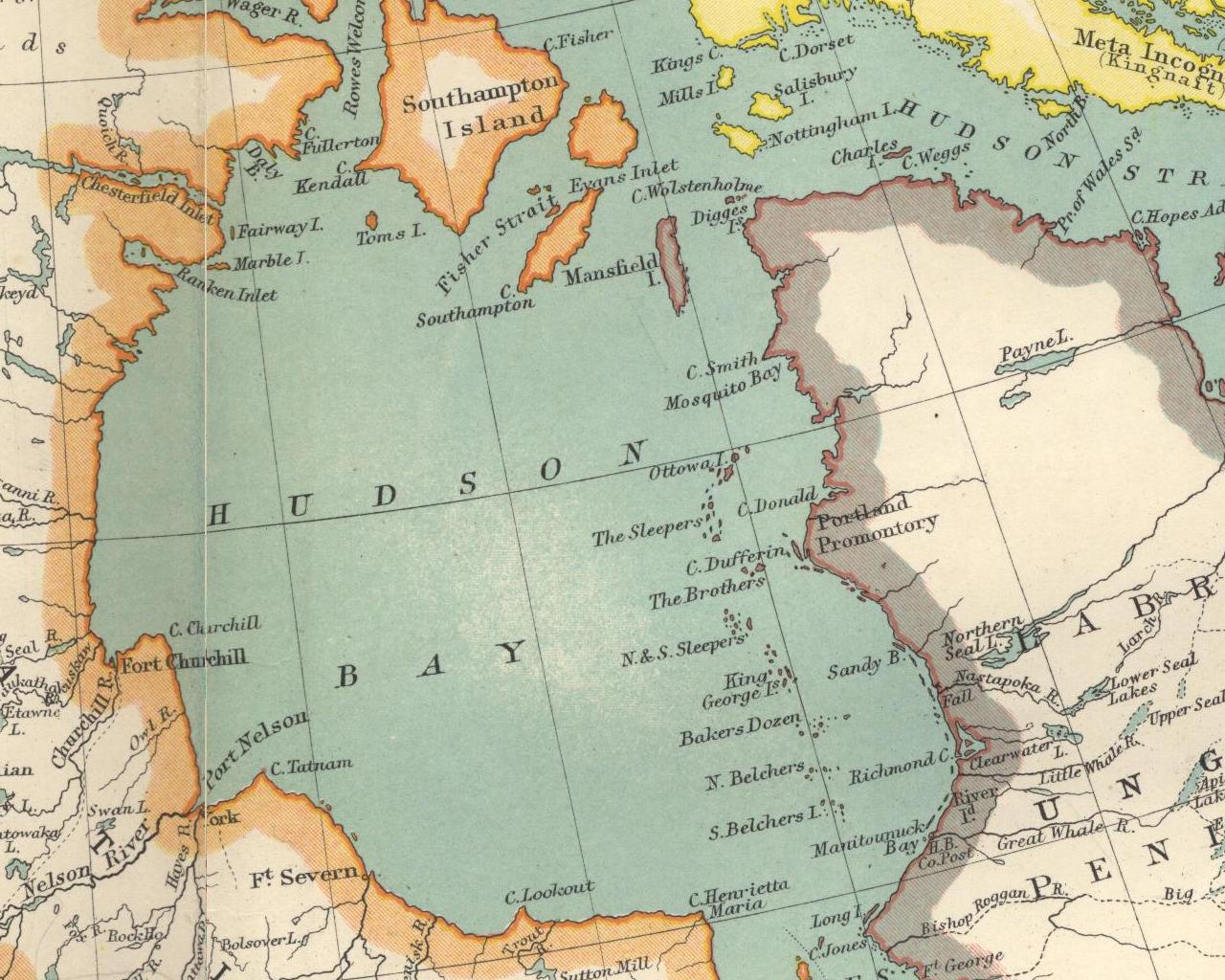
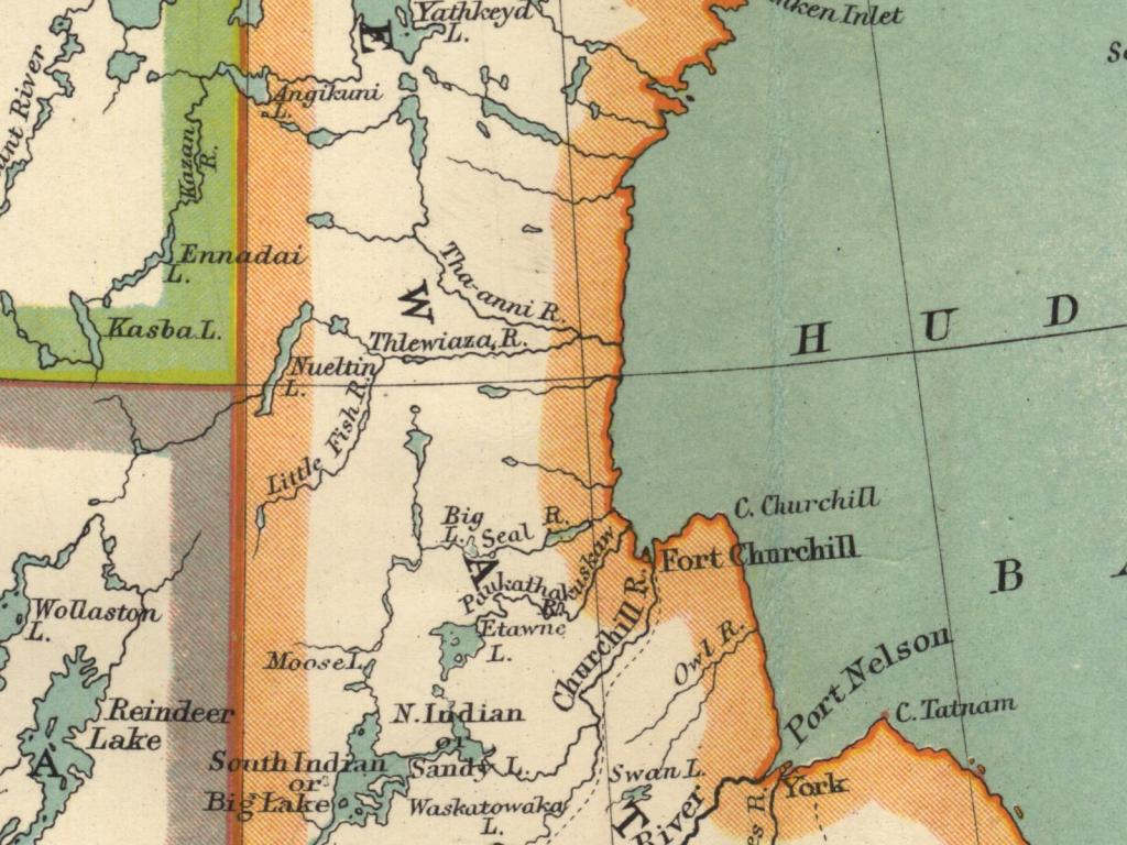
Moving a few hundred miles south, we find ourselves on the western shore
of Hudson Bay with an 800x600 image that has a very artistic feel to it.
The 1024x768 version is here. The 1280x1024 version is here. The 1600x1200 version is here.
| ||||||||||||||||||||||
|
| ||||||||||||||||||||||
|
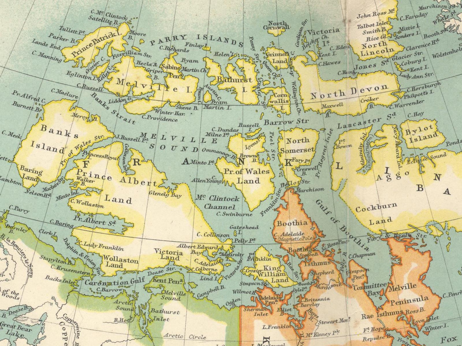
Finally, here's a set of sixteen clippings taken from different parts of the map.
There are four clippings of each size (800x600, 1024x768, 1280x1024 and 1600x1200).
Due to some recent additions to this page, some of these images are essentially duplicates of other images on this page. I'll probably replace these with fresh ones eventually. Unlike the other background images on this page, I'm providing each image in exactly one size. If the image you like is too small, contact me and I'll see about getting you a higher resolution version. If the image you like is too large, use your favourite image manipulation tool to scale and/or clip it to size or contact me and I'll see what I can do. I use the GIMP for all image work. It's open source software downloadable for free via www.gimp.org. If you can't find a version of the GIMP for your operating system, either use something else or ask a friend with a real operating system to give you a hand. Click on the small version of each clipping to get to the larger version.
|


