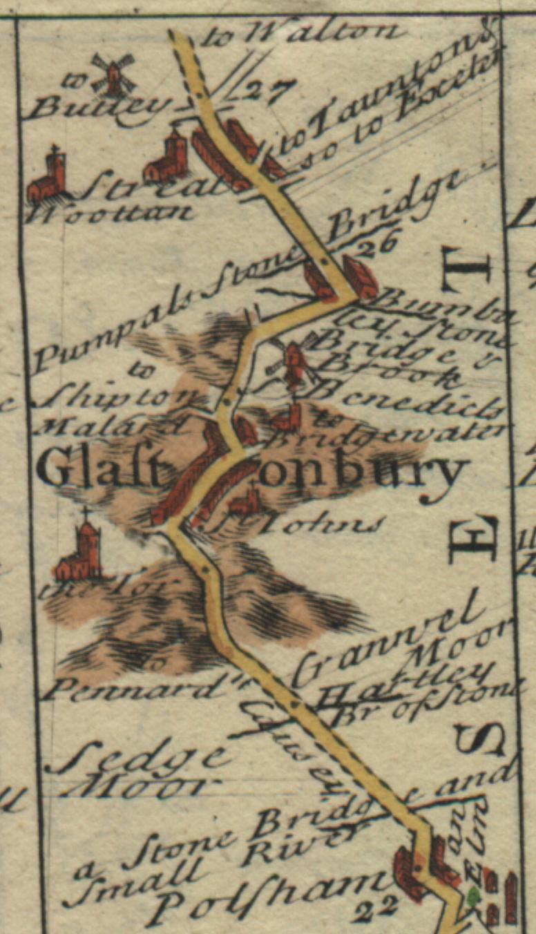
The Town of Glastonbury
Here's a view of the town of Glastonbury taken from page 155 of Owen & Bowen's
Britannia Depicta.
This small excerpt (3.3cm wide by 5.7cm high) is just crammed with illustrations
and information:
- two windmills
- five churches
- lots and lots of houses
- six mileage markers indicating the number of miles from the start
of the map.
Starting at the bottom of this image:
- mile 22 is the dot right in the middle of Postham
- miles 23, 24 and 25 are unlabelled because there is simply no room on
the map for the numbers
- mile 26 is right beside the Pumpals Stone Bridge
- mile 27 is at the very top right beside the turnoff to Walton
- numerous bridges
- even more numerous side roads (including indications of where they
go)
- hills around Glastonbury
Click here to get back to the main
Owen and Bowen maps page.

http://www.bouletfermat.com/owen_and_bowen/