These pages are an exploration of a few of the maps from John Owen and Emanuel Bowen's
Britannia Depicta.
This work, published by Thomas Bowles in a series of editions between
1720 and 1764, is a collection of roadmaps covering parts of Britain.
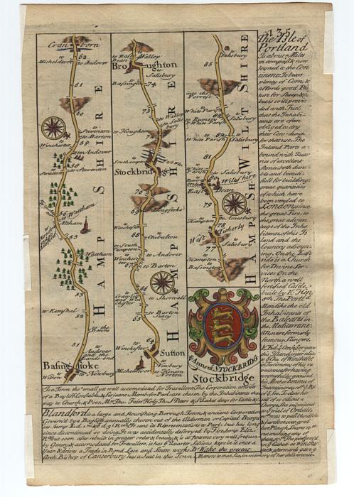
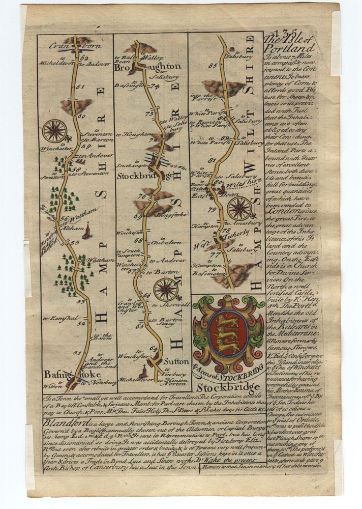
Each of the maps describes a route which starts in the lower left corner
and goes up the page in a series of columns ending at the top right
of the page.
Progress along the route is indicated by mileage markers which are
little dots roughly equally spaced along the center of the major road.
Cities, towns and villages are named along the way and
side-roads are marked with their destinations.
Useful landmarks are depicted including
hills, bridges, rivers and streams, windmills, churches, water wells and even a gallows.
Click here for a look at some of these landmarks.
The maps are packed with information which would be useful to an 18th century traveller.
For example, the orientation of the hills provides important topographical information.
If the hills are drawn upright (i.e. the top of the hills are towards the top of
the page) then this means that someone travelling along the road from the bottom to the top
of the map will experience an increase in elevation whereas someone travelling along the
road from the top to the bottom of the map will experience a drop in elevation.
Conversely, if the hills are drawn upside-down then someone travelling along the road
from the bottom to the top of the map will be travelling downhill at the point where
the hills are drawn.
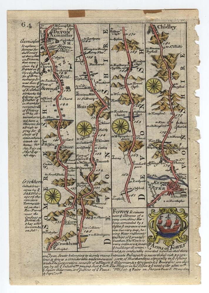
This clipping from the Devonshire map illustrates what I mean:
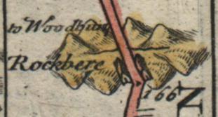
These hills depict a valley with a stream running through it. Travellers arriving at
this point from the top of the map will go down into the valley, across the stream and
then immediately up the other side (through the town of Rockbere).
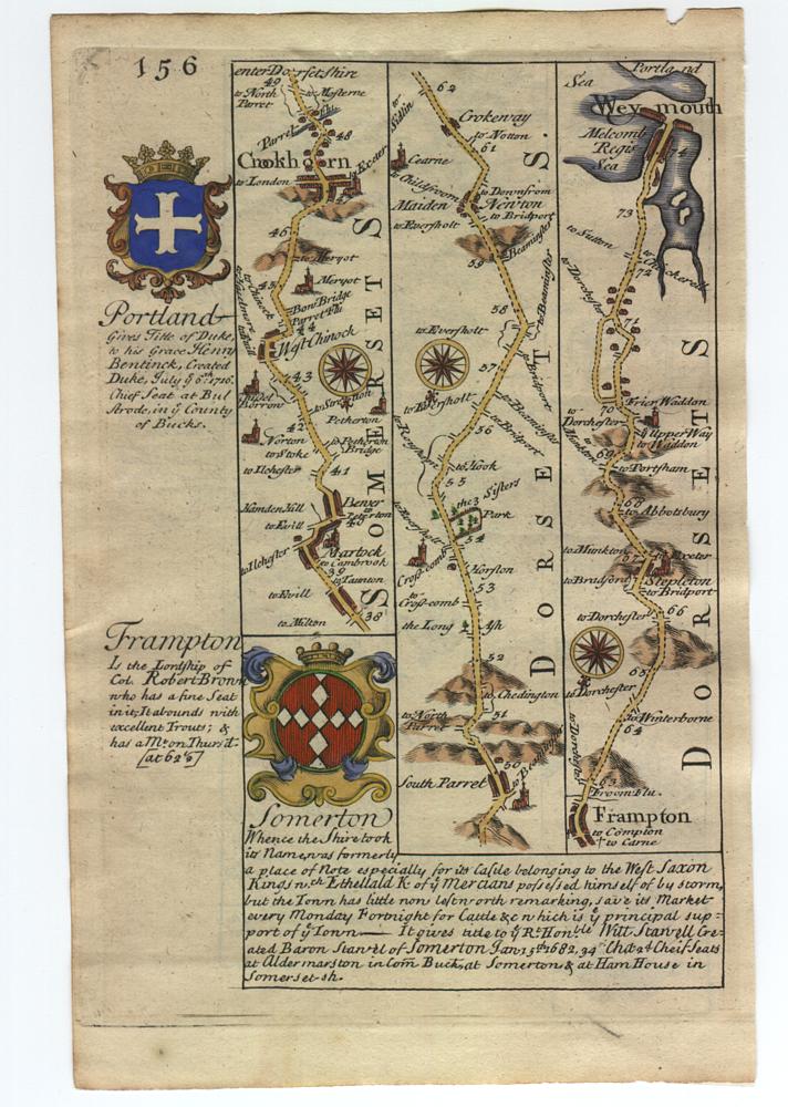
This section displays all of the maps that I own (three double-sided sheets).
Click on the page numbers to get a somewhat higher resolution view of each map (roughly 150dpi).
Although quite readable, these higher resolution images are still only about 1/4 the resolution of
my original scans (i.e. they have 1/16th of the number of pixels as my original 600dpi scans).
Most of the hyperlinks on this page point at pages containing clippings from the full 600dpi resolution scans.
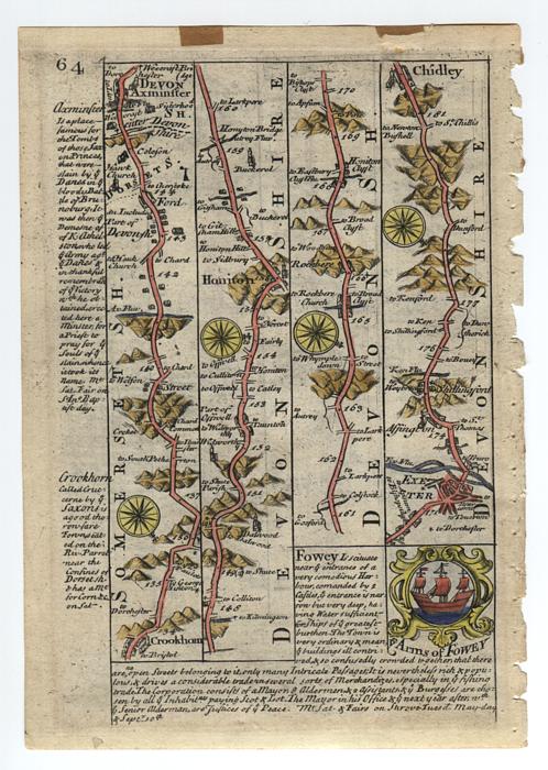
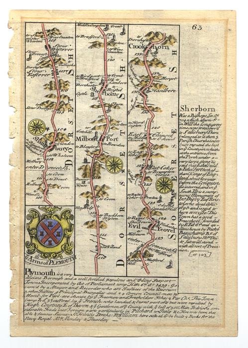
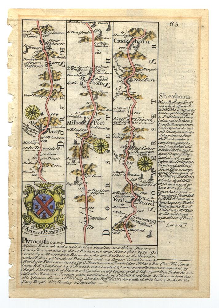
Here are pages 64 and 63
(they appear in this order so that the spine-edges
of the images meet in the middle of the page if your browser window is wide enough).
Click here for a look at Crookhorn
from the Plymouth map (check out the spectacular engraving of the hills around Crookhorn).
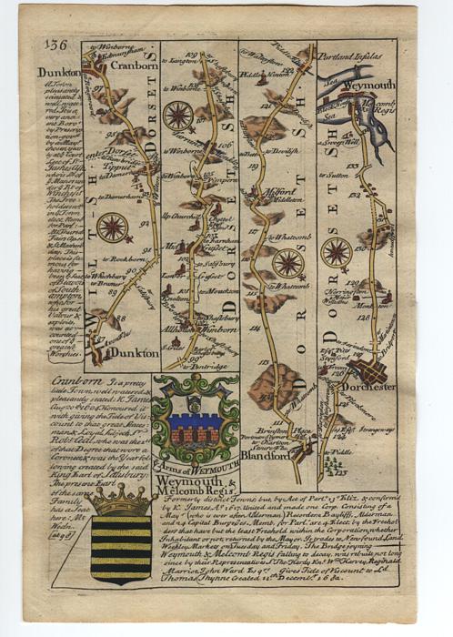
Here are pages 136 and 135.
Click here for a look at
Weymouth taken from page 136.
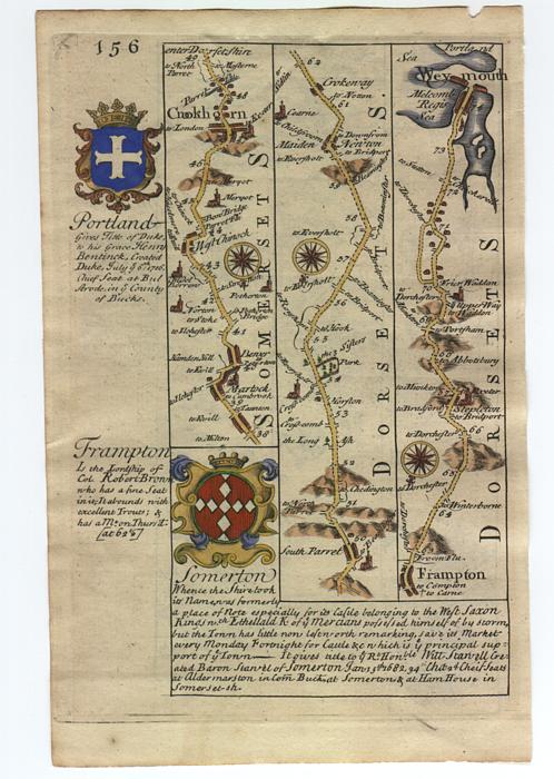
Here are pages 156 and 155.
Click here for a look at
the Deanery of Bristol's Shield.
Click here for a look at
Weymouth
and here for a look at
Glastonbury taken from page 156.
In modern terms, page 156 describes the following route:
Starting at the lower left of the map in Martock, roughly follow A356 south to what is today
called Crewkerne but was called Crookhorn in the early 18th century.
From Crewkerne, continue roughly down A356 through South Parret, Maiden Newton, Frampton and then on to Dorchester.
Switch to A354 and roughly follow it south to Weymouth.
Further, I believe that the 3 Sisters Park shown near the center of page 156
must have been very close to Kingcombe Cross Roads.


